It was a last minute change of plan, and I can’t remember now where I heard about the Mt. Townsend hike and abandoned my intention to go to Mt. St. Helens this week. Maybe I didn’t fully comprehend the elevation gain. I have a limit of 2000 feet or so, and it’s the first factoid I check on the WTA website—along with the mileage of course, which at eight miles is within my limit. This time I went straight for the trip reports. Wildflowers. Views. Also the weather forecast looks pretty good. I’m in. I forgot to check the elevation gain.
Mt. Townsend is in the Olympic National Forest, pretty far north on Hwy 101, a 2-1/2 hour drive. 101 skirts Hood Canal and is one of my favorite drives. Bonus, along with lavender ice cream in Hoodsport, the end-of-day pièce de résistance. I’m at Avenue Espresso at 5:35 and heading for Olympia on I-5 at 5:40, extra hot latte in the cup holder. The weather has been less than stellar lately, the way too hot days forgotten. There is some cloud cover; but the forecast for Quilcene is “mostly sunny”; I’m hopeful it will clear by the time I arrive.


After a directional glitch on the forest service road that costs me 30 minutes on an overgrown, potholed road, I arrive at the 20-car parking area at 8:20; already the 7th car. This is a popular hike, according to the WTA, but it’s a Friday. Still, I clearly won’t be alone on this one. I gear up, then hang back at the car to let a pair get ahead of me: a woman a bit older than I and, I venture a guess, her daughter. I would like to hike with my daughter someday. Maybe she will accompany me when it’s not safe for me to fly solo. Today, at 67 + one day, I hope the “not safe” day is still a while off.

I catch up to them when they stop. They catch up to me when I stop to take off my jacket I knew I wouldn’t need for long but wore anyway, and I let them pass. I don’t like people behind me, either on foot or wheels. I pass them once more and don’t see them again. It will turn out to be a well-traveled trail, even on Friday. Mostly the under-30s and the over-60s; or those who wouldn’t be caught dead using trekking poles and those who would be dead without them.
The sky is clear, or—as I will see when I reach the first break in the trees—I have ascended above the clouds. What a glorious day, and from the get-go, a beauty of a trail. I’m giddy.


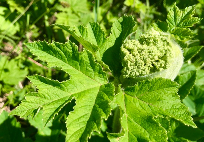
The rhododendrons are blooming on the lower trail, and when I climb above them the wildflowers begin. They are all coming into early prime time. I really do, so very much, want to know all their names. I need to double down my efforts to find a simple field guide, or make my own. I look them up and then forget. I see paintbrush, tiger lily, columbine, evergreen violet, bunchberry, phlox, early lupine, yarrow, Sitka valerian. I wish I had taken photos of everything for later IDing. I thought about it, and didn’t do it.


The most prolific is cow parsnip. I had to ask the women’s hiking FB group to identify it for me. It’s the smaller, less toxic version of the horrid giant hogwart; and its allium-like emergence is beautifully mysterious. “And the day came when the risk to remain tight in a bud was more painful than the risk it took to blossom” Anaïs Nin.

There is a first break in the trees and holy MOG, is that my destination? If so, I won’t be going there. (It’s not.)

There are very many switchbacks on this trail, but they are relatively gentle, my heart is not pounding. I’m not breathing hard. The trail is still mostly in the trees with breaks to the southeast and, though I’ve warmed up from the trailhead chill, I’m not overheated. And, if I need distraction, the alpine scent fills my nose. The heavenly fragrance makes me swoon. This is my hike.


And then…I come out of the trees in the other direction. Holy Goddess. Is that my destination? A big yes if it is! Ridge/meadow/top of the world. My most favorite trail features. (It is my destination.) A young deer pops out of the bushes, grazing her way up the slope. Usually I don’t see wildlife bigger than a chipmunk, so the viewing is a treat. She turns her head to look at me as a chipmunk scampers by, then returns to her mission.

The trail finally ascends above tree line for good and gets steep for the last half mile on loose rock. Okay, this part is brutal. But then the Julie Andrews moment: the anticipation of what is just over the top of the visual. It’s like Christmas morning. ShaZaam! My heart leaves my chest. I think I live for these moments.


And that is why the bear goes over the mountain to see what it can see.


It’s windy and chilly on top. I pull my jacket back out and put it on over my mother’s favorite UV shirt that I appropriated after she died. I hike out along the phlox-covered ridge, above the clouds like I’m in a plane looking down. They obscure the view of Hood Canal to the east, but Discovery Bay near Port Townsend at the end of the Olympic Peninsula is visible, and the view to the west of the mountains and the town of Sequim are nearly cloud-free.


There are people up here, but I hike on and find wind protection behind a rock to sit and eat my homemade trail bar, apples and cheese. The clouds shift and I realize Mt. Baker is right in front of me. I spot, possibly, the cone top of Mt. Hood in the far distance above the cloud sea. I expect the other snow caps are out there too: Adams and Rainier; maybe St. Helens. But they will wait until next time. There will be a next time, though I am aware that a cloud-free day later in the summer (next year) may not have wildflowers, and there may be smoke. Do-overs of favorite trails carry the risk of “not as good as I remembered.”

After lunch, with the arrival of more people, I loop back along the west side below the top of the ridge, and head down the mountain.
I feel the elevation drop on the downhill. It’s brutal with not a single level spot or rise to give a break to my hip flexors. The right one is screaming long before I see the parking lot ahead. I stop and chat with two gentle, soft spoken women my age, Barbie and Kathleen from Indianola, WA. They ask if I enjoy hiking alone. They alert me to the song of the hermit thrush, telling me I will hear it for the next half mile. Maybe after I learn the flowers, I will move on to birds. I can’t carry a field guide to bird song though. They tell me they have hiked this trail many times. Rarely have I enjoyed talking to someone on the trail so much as them. I want to know them.
The clouds had begun upwardly expanding by the time I left the ridge, and I’m glad I was there early.


Back at the car, I strip off my pack, my mother’s shirt and my knee straps, exchange boots for tennis shoes, and head for Hoodsport and my ice cream reward. But there is a bad accident on 101 with a 30-minute delay. I skip the ice cream. Suddenly a shower and the ibuprofen bottle are calling more loudly.
When I get home, and a friend asks “Doesn’t that trail have wicked gain?” I check that gain. 3200 feet. I’m glad I didn’t know; I might not have gone.


When you meet hikers you like, give them your blog page name so they can follow your adventures!
LikeLike
You know, I thought about digging out a blog card, but decided it was too self-indulgent. I did verbally tell them how to find my Airbnb should they want to do some hiking down south. 😉
LikeLike
Wha???? Haven’t you heard of shameless self-promotion?? Go ahead and give out blog cards.
LikeLiked by 1 person
Wowsa! I agree with Christina. Wonderful storytelling! The photo of you at the top…I just love. Thanks for sharing!
LikeLike
Thank you, Sweetie.
LikeLike
I love this whole piece! The tone of your story-telling, and the views, and your plucky self. Sorry you missed the ice cream, but it was a creme de la creme kind of day!
LikeLiked by 1 person
Thank you, Christina. And yes it was!
LikeLike
Idyllic hike, o lucky one! Guess you are right-living! Love my part as the shar-ee!
LikeLike
It was idyllic! Lucky me, for sure.
LikeLike
Beautiful!!!
LikeLike
Thank you.
LikeLike